Hersheypark had not produced any maps of the park until 1972, when a map of the park produced by a third party was put into the park’s rack brochure and a “Welcome to Hershey” handout that was likely an additional rack brochure that was only available in Hershey.
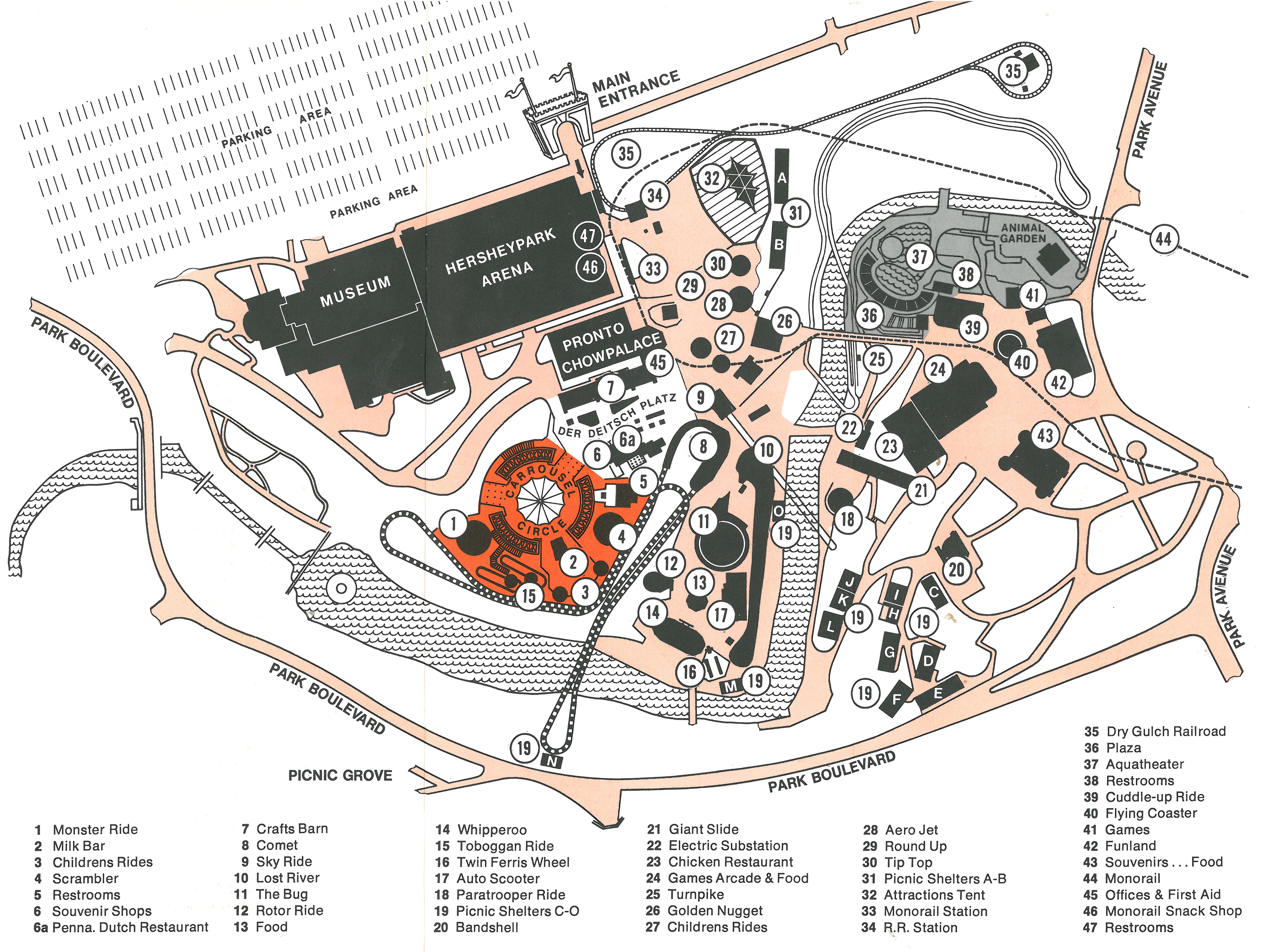
In 1973, Hersheypark produced another map for its rack brochure, this time using a more cartoonish style, but updated to show the new Tudor Castle entrance of the park, and new rides – Coal Cracker and Giant Wheel. A similar map was produced in 1974 that was updated to include the new Sky Ride and Trailblazer rides. 1974 was the first year that Hersheypark produced a souvenir map, something other parks (such as Cedar Point and Magic Mountain) were also producing.

From 1975-1978, Hersheypark did not include a map in their rack brochure. The handouts at the park were simple double-sided printouts of entertainment schedules, and some general information about the park. The park did produce souvenir maps in 1975, 1977, and 1978.
Hersheypark map handouts
1979 was the first season the park included a map in their handout at the Main Gate. The park has produced a map for every major park season, including the summer season, Springtime in the Park, Hersheypark In The Dark, and Hersheypark Christmas Candylane, since that year.


The park maps changed styles over the years, switching from small sized formats to larger broader formats, back to smaller formats seen in more recent years. The Hersheypark Maps Database has more maps to view.

The fate of souvenir maps
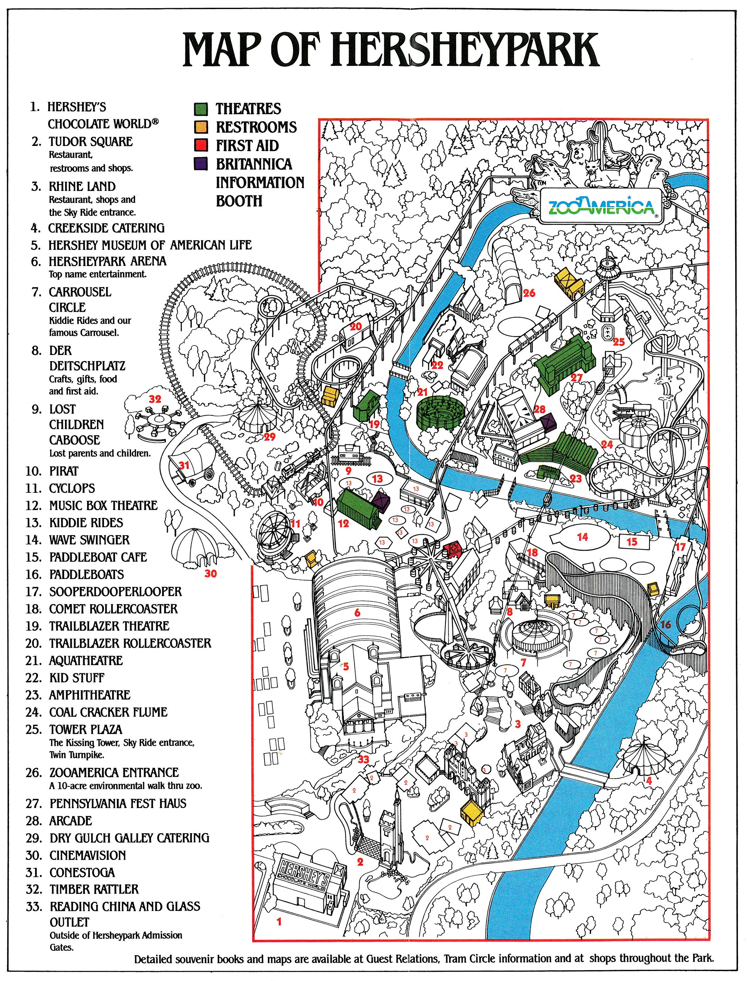
Souvenir maps were produced in the 1980s and 1990s, and a souvenir map book was produced in 1982 and sold for three seasons through 1984. Souvenir maps returned in 1987 for the park’s 80th anniversary, and were produced from 1988 to 1990. The 1995 souvenir map was the final souvenir map that Hersheypark produced. This map was updated with a sticker for the 1996 season to note that Wildcat was added to the park. This souvenir map was sold in the park through 1997 and was discontinued.
Hersheypark app
The Hersheypark app also has a map, which has been regularly updated since the app was released in the early 2010s. The earliest version update dates back to 2014.

The fate of printed maps
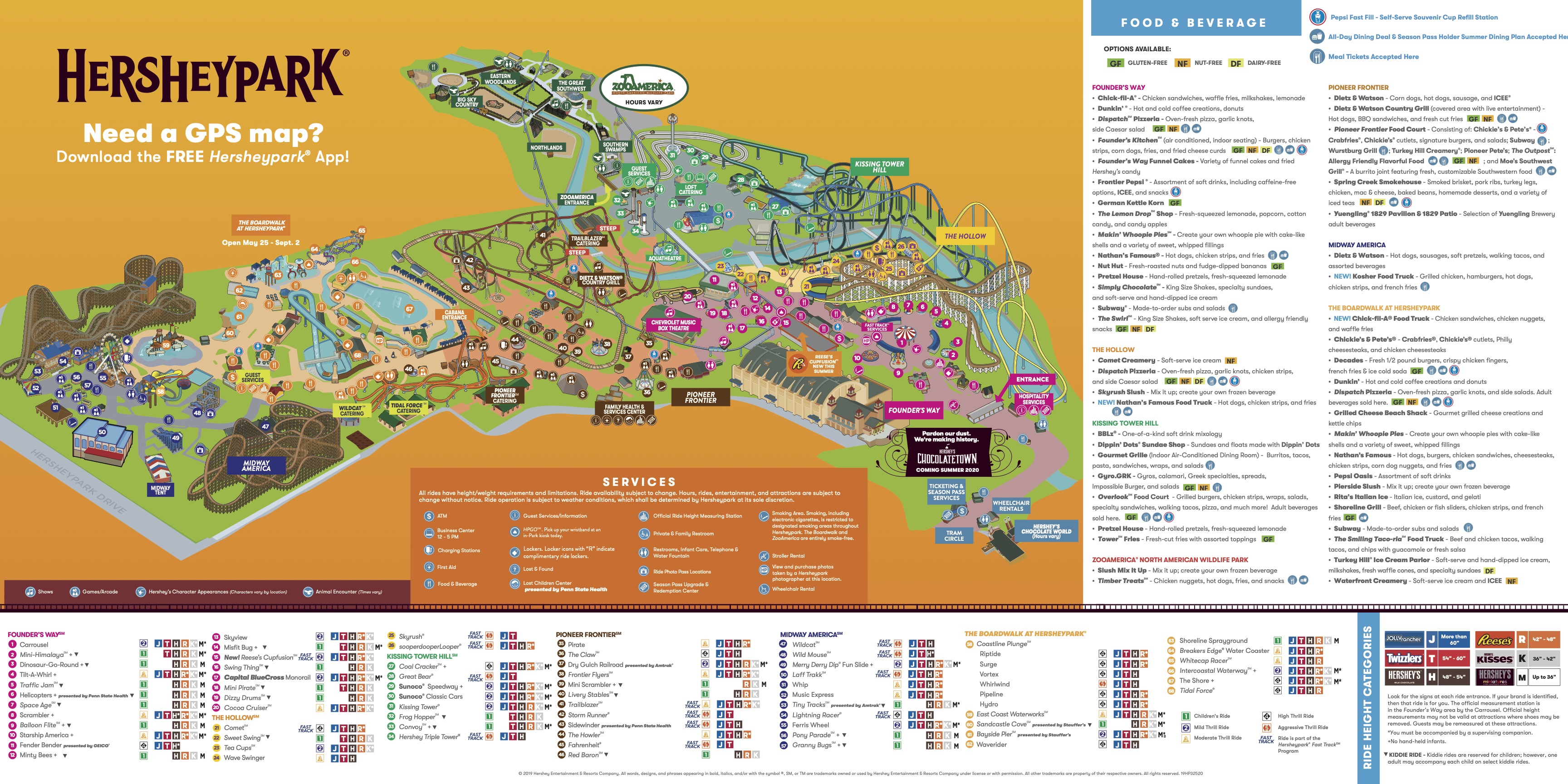
When the COVID-19 Pandemic postponed the start of the 2020 summer season, Hersheypark discontinued printing maps of the park. This continued through the 2021 and 2022 seasons. However, Hersheypark launched Dark Nights in 2022. For this event, they printed a map of the park with the Dark Nights scare zones and haunted houses labeled. Maps of Hersheypark can still be found on Hersheypark’s website and Hersheypark’s app.

Would you be interested in supporting The Amusement Parkives? It would be greatly appreciated!
Click here to learn more.