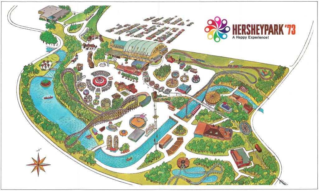
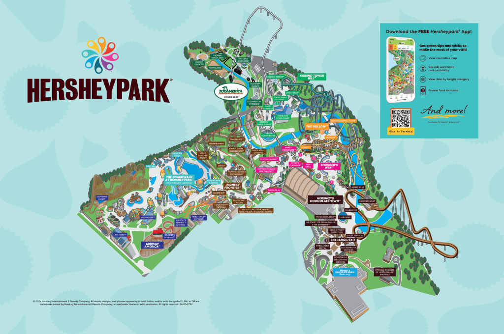
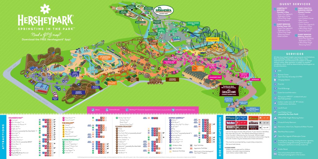
This is a library of Hersheypark maps. Click on the links below to access whatever year you are interested in. Hersheypark began making map guides in 1972. From 1975-1978, map guides were not produced. However, Hersheypark offered poster-sized souvenir maps.
The maps guides in this library from 1972 to 2018 are nearly all scanned from physical paper maps. 2019 has yet to be scanned so a digital version is being used. Hersheypark discontinued printing maps following 2019, so all maps after 2019 are purely digital.
It’s not clear when some souvenir maps were made – it’s apparent that a souvenir map was not made in 1976, that the 1982 souvenir book was reprinted in 1983 and 1984, and that the 1995 souvenir map continued to be sold in 1996 and 1997. It is unknown if Hersheypark produced a souvenir map between 1991 and 1994. Hersheypark has not sold a souvenir map or book since the 1998 season.
Donations to the Maps Database
The Amusement Parkives does accept donations to the Maps Database. The database still needs physical paper maps from any seasonal events.
If anyone would like to donate a copy of the maps missing from the library please contact the site via The Amusement Parkives Facebook page, or you can email Harry Michelson at this email address.
All summer maps are part of The Amusement Parkives collection. If there is not an image of one, it means the map just need to be scanned. Once that is done, it will be uploaded to the site.

Seasonal event maps
Spring maps
Halloween maps

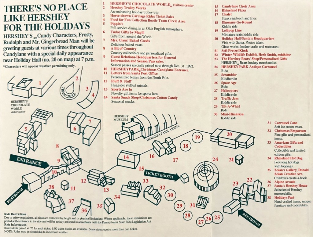
Christmas maps
Souvenir maps
Souvenir maps | 1974 – 1980

Other maps of interest
- 1951 Pennsylvania Dutch Days map
- Maps of Pioneer Frontier Food Court
- Hershey Entertainment Complex facility parking maps
Would you be interested in supporting The Amusement Parkives? It would be greatly appreciated!
Click here to learn more.